The forgotten route of the ancient builders
In this article
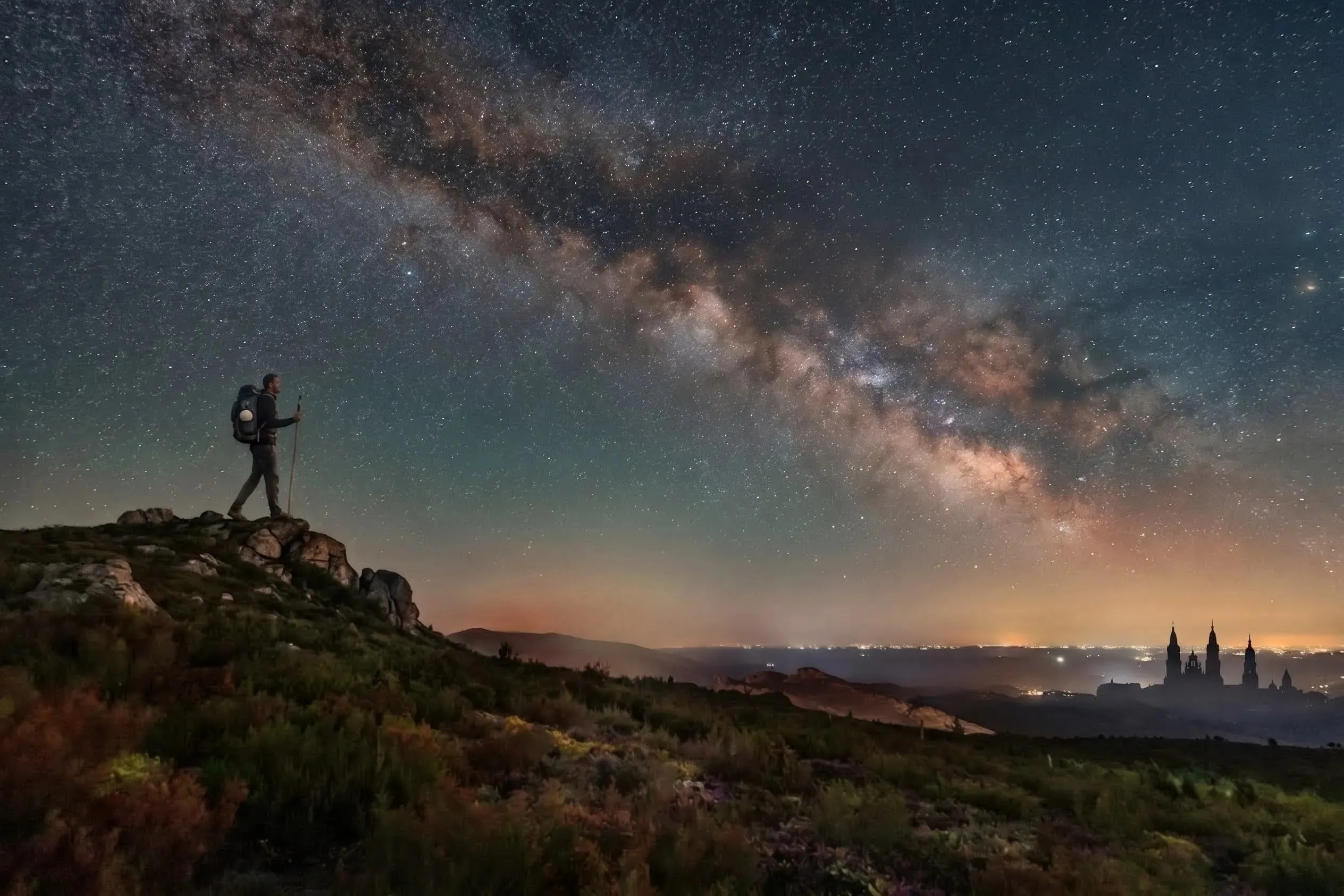
Illustration showing the Milky Way as a night guide for pilgrims.
Long before the French Way to Santiago de Compostela existed, an initiatory route of builders already crossed the Pyrenees. I rebuilt its path from the clues left by Louis Charpentier.
Anyone walking to Santiago de Compostela today follows a well-marked trail. There are yellow arrows painted on signs, walls, posts and sidewalks; hostels every few kilometers; maps, books and guides that describe every church and every legend along the way. Everything seems designed so that no one gets lost. And perhaps that is exactly the point that deserves attention: a path so carefully prepared to be walked by crowds may itself be the result of a choice. Someone decided where the pilgrims should go.
That was the intuition that guided Louis Charpentier when he wrote Les Jacques et le mystère de Compostelle, published in Paris by Robert Laffont in 1971, in the Les énigmes de l’univers series. The book reached Brazil and other Latin-language countries under the title O mistério de Compostela (The Mystery of Compostela). Its thesis is uncomfortable and fascinating at the same time: the French Way to Santiago as we know it would be the late Christianization of a much older route, predating the cult of the apostle, walked not by penitents seeking salvation but by builders seeking knowledge.
Although some of his claims would need to be confirmed by the methods of historical science, his reading is coherent enough to spark a legitimate curiosity: what if the original path of this route could be recovered? It was from that question that I built the map in this article, trying to uncover this ancient initiatory route.
Before going further, it is only fair to tell the reader who Charpentier was and what effect his work had. He was not an archaeologist or an academic historian. He was a journalist, a pilgrim, a traveler and a publisher, and he came to the subject of the so-called traditional sciences after observing the effect of megaliths on the behavior of animals and plants.
In 1966 he published Le Mystère de la cathédrale de Chartres (The Mysteries of Chartres Cathedral), which became a popular success and turned him into one of the most widely read names in the wave of mystery literature that swept France and Europe in the 1960s and 1970s. It was on that momentum that Les Jacques et le mystère de Compostelle arrived, received with enthusiasm by readers interested in esotericism and symbolism, and with reservations by critics who saw in his chains of reasoning something between erudition and free speculation.
The French Way to Santiago as we know it
It is worth starting with the present, because everything else moves away from it. The main route to Santiago de Compostela today is the so-called French Way, the Camino Francés. It starts in Saint-Jean-Pied-de-Port, on the French side of the Pyrenees, crosses the border at Roncesvalles and continues through Pamplona, Puente la Reina, Logroño, Burgos, León and Ponferrada until it reaches Santiago, in Galicia. It is the most walked route, the best documented and the best served by hostels. When someone says they are doing the Camino, this is almost always the one they mean.
Map of the current route of the French Way, from Saint-Jean-Pied-de-Port to Santiago de Compostela.
It is worth remembering that the Christian pilgrimage to Compostela is, historically, something relatively recent. It was only born around the 9th century, when a rumor spread through the Christian West that, in a corner of Galicia free from the Muslim invasion, holy men guided by mysterious lights had discovered the tomb of the apostle Saint James the Greater. Over time the legend grew, there was talk of miracles, and people from France, Italy, Germany, Portugal and England began to take to the road. It became fashionable: whoever could not go to Jerusalem or Rome set out for Santiago.
This is where an aspect comes in that helps explain the dynamics of these medieval pilgrimages. They were organized around relics, that is, physical remains of saints or objects connected to them, considered sacred and capable of working miracles. An important relic drew crowds, and with them came donations, prestige and traffic for the town or place that housed it. Pilgrimage routes were therefore drawn from monastery to monastery, from basilica to basilica, from relic to relic, as a succession of devotional stops that led the pilgrim to the final destination. The apostle’s tomb in Galicia was the great magnet of this movement, and the scallop shell that pilgrims began to wear as their badge came precisely from the symbols and legends surrounding the arrival of the saint’s body by sea. Seen this way, the pilgrimage was as much an enterprise as it was a matter of faith.
It is no accident that the French Way is also the first pilgrimage route in Europe to get something like a travel guide. Around the 12th century, the so-called Codex Calixtinus, or Liber Sancti Jacobi, was compiled: a manuscript partly attributed to the French cleric Aymeric Picaud, gathering sermons, miracles and accounts connected to the apostle. Its fifth book describes the stages of the route, the peoples and customs of each region, the shrines to visit and even the dangers of the road, working as a true pilgrim’s handbook. The revealing detail, for Charpentier’s thesis, is that the same Codex also contains the Historia Turpini, the account that gives Charlemagne and his knight Roland a heroic role in opening the route. Charpentier reads this association with suspicion. For him, the organizers of the route were skilled in the art of publicity and recruited the already celebrated figure of the emperor, who never set foot in Compostela, to lend prestige to a pilgrimage they needed to promote. In this reading, the medieval guide does not merely describe the French Way: it helps build it, shaping the legend that justified it.
So keep this path and this origin in mind, because Charpentier’s argument is born from a comparison. The route he tries to recover does not coincide with the French Way and is far older than the cult of relics. It enters Spain through another point in the Pyrenees, follows mountain gorges and only crosses the current route at specific places.
The Way of the Stars
Charpentier’s first clue comes from a curious object. Charlemagne’s reliquary bore an engraving of the direction of Compostela, marked by two rows of stars. Charpentier does not read them as ornament, but as a map.
There is an old reason for this association between Compostela and the stars. In popular tradition, the Camino de Santiago is the Milky Way itself, that trail of stars that crosses the night sky toward the constellation Canis Major. Pilgrims walked west with that band of light pointing the way at night. The name Compostela, by the way, is often linked to campus stellae, the field of the star. Sky and earth, in this reading, repeat the same design: a corridor running from sunrise to sunset.
For Charpentier, the two rows of stars on the reliquary correspond to two parallel lines that cross the Iberian Peninsula from the Mediterranean to the Atlantic. And what would support this reading is toponymy. Along these lines, he finds a succession of place names connected to the star: the Pic d’Estelle and the Puig de l’Estelle in Catalonia, Estella in Navarre, whose Basque name Lizarra also means star, and Lizárraga as well, farther on toward Galicia. These points are spread over almost a thousand kilometers, and nearly all of them line up around two very close bands of latitude.
The first line runs near latitude 42°30′. The second, a little farther north, near 42°50′. Compostela sits at 42°53′, slightly off, but the Pico Sacro, which legend points to as the apostle’s first tomb, lies very close to 42°46′. Charpentier sums up the argument bluntly: lining up several points on the same parallel, over a thousand kilometers, is not a matter of chance. It requires geographical and astronomical knowledge. It requires instruments. And it requires that someone, long before the Christian Era, knew where they were.
This is where the story gets interesting for anyone who wants to uncover this ancient route. Charpentier does not speak of a single line, but of a band. The original route would run between latitudes 42°30′ and 42°50′. That band is what I used as the frame for the cartographic reconstruction.
Map showing the band bounded by latitudes 42°30′ and 42°50′, laid over the north of the Iberian Peninsula.
Within this band, the places the author mentions stop being a list of curious names and start drawing a corridor. It is as if the sky, with its Milky Way, had been projected onto the ground between two parallels.
Charpentier goes further and notes that the road to Compostela is not alone. There would be similar axes at other latitudes of Western Europe, all ending at the Atlantic. One links Sainte-Odile, in Alsace, to the tip of Brittany, near 48°. Another runs from Dover, in England, to the coast of Cornwall, near 51°. And there would be a fourth, passing through Le-Puy-en-Velay, near 45°. Together, they would form a regular progression: 42, 45, 48, 51. The symmetry may be coincidence or evidence, but it serves the purpose of placing Compostela within a larger pattern rather than as an isolated case.
The builders and their marks in stone
Charpentier calls the ancient builders who traveled this route Jacques. They were not ordinary pilgrims. They were masons, craftsmen, stonecutters, organized in brotherhoods that crossed Europe raising churches, monasteries and fortresses. The legends of these fraternities do not invoke the apostle, but a “Master Jacques”, an archetypal stoneworker said to have taken part in building the Temple of Solomon.
The relationship of these people with the route is old, and Charpentier traces it back to a past long before Christianity. All along the route, and especially in its final stretch, in Galicia, the ground is covered with megalithic monuments: dolmens, burial mounds, menhirs, carved stones. In the province of Pontevedra alone, which corresponds to the last stretch of the way of the stars, he points to more than a hundred sites with dolmens or tombs bearing petroglyphs, those carvings made in rock in Neolithic times. These signs, for him, are neither decoration nor pastime. They are a form of writing we still cannot read, deliberately placed in chosen spots and protected by stone walls.
The detail that ties everything together is the continuity of the signs. The same strokes that appear in Neolithic petroglyphs reappear, centuries later, in the marks the builders left on the stones of the churches they raised along the route. Each free stonemason carved his own sign, his signature, into the stone he worked. That sign was not just identification. It was proof that this man took personal responsibility for his work, and therefore that he was a free man, who freely disposed of what he produced. Charpentier notes a curious fact: these marks appear in Romanesque churches, but tend to disappear in civil monuments, in fortresses and in later buildings, as if the freedom of the craft had also been lost over time.
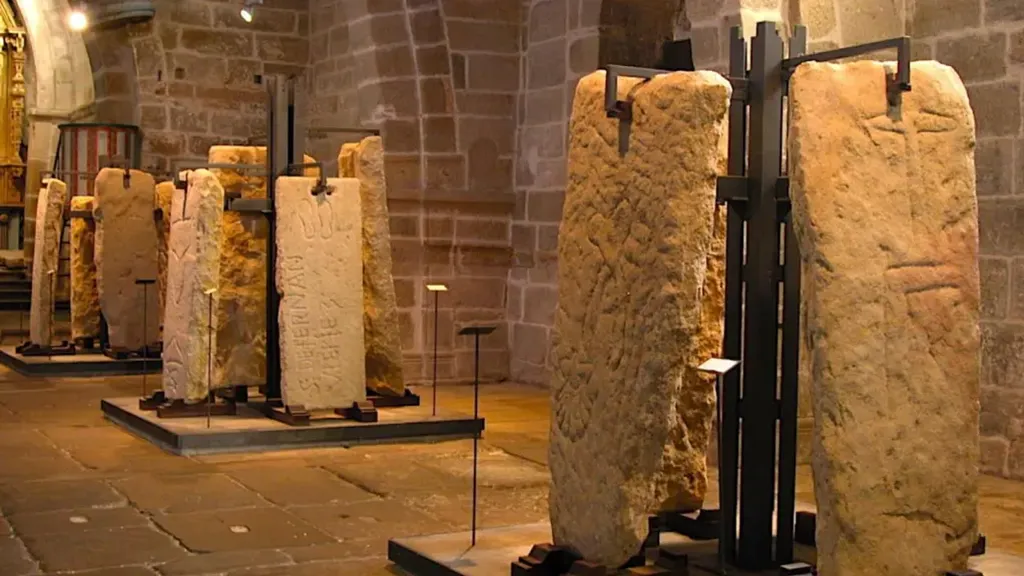
Gothic church and cemetery of Santa María A Nova, in Noia, with more than 500 inscribed medieval tombstones.
There is one place where this tradition shows itself in an almost enigmatic way. In Noia, in Galicia, there is a group of medieval tombstones covered only with drawings, with no name at all, no inscription. Just carved signs, similar to those of the petroglyphs and to the builders’ marks. Charpentier interprets them as the graves of initiated masters, people for whom a name no longer mattered. The initiate, in dying to the world, loses his name but keeps his qualification, expressed in signs.
The seven gates of the initiatory route
Charpentier describes the original route as a sequence of seven gates. The word deserves an explanation, because it does not mean a physical gate, but something closer to a ritual passage.
Each of the seven gates is a mountain gorge, a narrow and difficult passage between two worlds. Geographically, it is the point where you cross from one valley to another. Symbolically, it is a trial to be overcome, a threshold.
In almost every initiatory tradition, moving forward means crossing a series of thresholds, and with each crossing the initiate leaves a former state behind and is born into a new one. The underlying idea, which runs through the whole book, is that you do not change without being reborn, and you are not reborn without first dying to what you were. Initiation ceremonies, almost everywhere, symbolically begin with a death. The old man is killed so that the new one can be born.
That is why the gates tend to be associated with caves. The cave is the womb of Mother Earth, the place the initiate enters to die and leaves transformed, as if born again. It is no accident that several of these passages lead to caves that were later covered by churches, as if Christianity had built over the site of the ancient rite. The word itself reinforces the reading: several of these places carry, in Basque, the idea of a gate in their names.
The route would then be a succession of seven deaths and seven rebirths, from the first passage to the last, made up of 7 gates:
- The first gate is near Jaca and leads to San Juan de la Peña, not by the current road, but through Atarés or Santa Cruz de Serós. Atarés, precisely, comes from atari (which means “gate” in Basque). This was where one entered the route, with the first rite celebrated in the cave where the monastery would later be built.
- The second is the Alto de Loiti, preceded by the village of Aldunate, a name that once again holds the Basque ate (which also refers to a “gate”). It gives access to the Sierra de Alaiz and its cave.
- The third is the long gorge of Estella, which follows the river and opens into La Rioja, passing through the Echegárate pass, a name Charpentier translates as the stonemason’s pass.
- The fourth is the Pancorbo gorge, between Miranda and Briviesca.
- The fifth gate opens the way into the Mountains of León, not by the Manzanal road, but through the gorge the railway follows by Porquero. It opens onto the fertile plain of El Bierzo, where the Templars raised a huge fortress in Ponferrada, marked not with the cross but with the letter Tau.
- The sixth is the Piedrafita pass, which leads to O Cebreiro, home to one of the oldest hospices on the route, in a small Celtic village that still keeps its thatched-roof pallozas. It is the point where one enters Galicia, land of Lug, the Celtic god who gives Lugo its name.
- The seventh is the Paso de Oca, which leads to Compostela, but above all to the Pico Sacro, the sacred mountain where legend places the apostle’s first tomb. This same path also leads to Padrón and Noia, the two points where the route meets the sea.
The original route and the French Way do not always run apart, nor always together. They touch at some points and pull away at others. The builders’ original route enters Spain through the Somport, not through Roncesvalles, so along the whole stretch of the Pyrenees the two stay separate. They meet for the first time at Puente la Reina. Then they diverge again and coincide once more at León and Ponferrada, overlapping from there on as far as Portomarín.
It was from this logic of meetings and partings that I reconstructed the route, and each of my references covered one stretch. Charpentier’s seven gates provided the backbone and the initiatory meaning of the journey. The Aragonese Way (Camino Aragonés) helped recover the start of the route: it sets out from Somport, passes through Jaca and Aldunate and reaches Puente la Reina, where it meets the French Way. The Camino Olvidado, or Forgotten Way, an old pilgrimage route to Santiago that crosses northern Spain below the Cantabrian Mountains, was essential for recovering the central stretch: it passes through Aguilar de Campoo, Guardo, Cistierna and San Miguel de Escalada before reaching León, where it once again touches the French Way. Combined with the band of latitudes, these references overlap and draw a coherent corridor.
The ending, however, is where the recovered route breaks away from the modern one for good. On reaching the Pico Sacro, instead of heading to the cathedral of Santiago, it turns toward Padrón and, from there, to Noia, ending in front of the ocean at Finisterre. It is this final divergence that best reveals the difference in purpose between the two routes.
Map showing the band of latitudes and the path of the recovered initiatory route, combining the seven gates, the Aragonese Way and the Camino Olvidado
The influence of the Order of Cluny
To understand why this ancient path turned into the French Way to Santiago de Compostela, we need to talk about the monastic Order of Cluny.
Cluny was a Benedictine abbey founded in the 10th century in Burgundy, France, which became the center of a network of monasteries spread across all of Europe. At its height, the Cluniac order brought together hundreds of houses that answered to a single abbot. It was one of the most powerful institutions of the medieval West, with influence over kings, popes and the very way faith was lived.
There is, however, one aspect of the abbey of Cluny that matters particularly to this story: the Benedictines were builders. A good share of the monks were carpenters, stonecutters and masons. Many abbots were themselves master builders. The art of building reached one of its high points with the Order of Cluny, and the order was a breeding ground for master builders in the Middle Ages.
In the first quarter of the 11th century, the Order of Cluny took possession, so to speak, of the road to Compostela. The process began with the introduction of the Cluniac rule at the monastery of San Juan de la Peña, in 1025, with the support of King Sancho of Aragon. Spanish monks traveled to Cluny, Cluniac monks came to Spain, and the exchanges spread. It was at this time that the Order of Cluny opened the Roncesvalles route to pilgrims, easier than the Somport, and organized the network of monasteries, hostels and hospitals that made the pilgrimage accessible to crowds. It was also along this road that the French Way took shape.
This is where Charpentier’s reading gains strength. He notes that the Order of Cluny did not destroy the ancient tradition. It did something subtler: it steered the pilgrims away from it. It opened a parallel route, comfortable, lined with hospitals, and led the mass of penitents onto it. The “tourist route”, so to speak, was drawn alongside the way of the stars, not on top of it. Past Estella, which could not be avoided, pilgrims were led toward Logroño, Burgos and the plain, away from the megalithic and sacred sites of the original route. No Paso de Oca, no gathering at Padrón, no Noia. Just a quick wash at Lavacolla and the right to shout for joy at the sight of the towers of Compostela.
Charpentier suggests this may have been deliberate, and even desirable. For those seeking a path of knowledge, the tourist was a nuisance on the road. Keeping the two crowds apart protected whatever remained initiatory in the old route. At the same time, and this is important, Cluny does not seem to have tried to erase the pagan tradition at its base. On the contrary, the Burgundian abbey is said to have sent its own workers to learn in that kind of itinerant university. Some say the great art of Cluny was born, in part, on the road to Compostela itself.
Builders, not just pilgrims
Along the road to Compostela paraded penitents, mystics, beggars and highwaymen. But, according to Charpentier, the builders walked ahead of them all. And they did not make the pilgrimage as penitents or as mystics. They walked as apprentices, as candidates for initiation, seeking knowledge tied to their own craft.
The route would then be a great school. It is said that without the road to Compostela, Romanesque art would not have been what it was, nourished by a rediscovered symbolic science applied in the churches that rose along the route.
The caves of San Juan de la Peña, Santa Cristina and Sasabé would have been places of ritual, where initiation took place in the womb of the earth before being covered by Christian chapels. The octagonal chapels, like the one at Eunate, whose Basque name supposedly means the hundred gates, repeat the shape of the primitive cave and a ritual that has been lost.
The alchemists themselves called the long laboratory work that, through successive trials, led to the philosopher’s stone the road to Compostela. It is no accident that when Nicolas Flamel travels the route, it is not in Compostela that he finds what he is looking for, but in León, with a learned Kabbalist, going from student to adept.
León, by the way, holds a special place in this reading. Charpentier likens it to Chartres and Glastonbury, places he calls places of illumination, of birth. As if the meaning of the route lay not in the tomb at the end, but in the transformation that happened along the way.
Walking as a method: the body, the earth and the setting sun
The road transforms whoever walks it. Charpentier puts forward an idea that may be the most intriguing in the whole book: the transformation would come not only from the destination, nor from the rites in the caves, but from the very act of walking. On foot, in friction with the earth, day after day, the pilgrim’s body would fall into tune with rhythms that sedentary life makes us forget.
Whoever walks for weeks, overcoming fatigue, step after step, ends up adjusting their inner rhythm to the rhythm of the Earth itself and of the cosmos, to the cycle of dawn, day, afternoon and night. Charpentier speaks of a kind of impregnation, an awakening of senses that had been dormant. Modern man, bound to the rhythm of machines and seated in his vehicles, would have lost contact with these currents of old Mother Earth, which he describes as the giver of all gifts. The road would be a way of finding them again.
Direction matters in this line of reasoning. The route runs from east to west, against the rotation of the Earth, toward the setting sun. For Charpentier, marching against the planet’s spin, following the sun in its descent, is no ordinary gesture. It is an almost instinctive act. And that is precisely what would explain why the ancient pilgrimage lines follow the course of the Earth’s parallels so exactly: it is not only about reaching a place, but about traveling an axis, making the body cross a specific band of the globe in the direction of the sun’s movement.
There is also a third element added to the march and the direction: the ground you walk on. The ancients knew, according to Charpentier, how to choose the places where they raised their megaliths, places endowed with telluric properties that acted on plants, animals and people. The caves, the dolmens, the carved stones that dot the route would not be scattered at random, but placed on veins of earth energy. Walking this route would then mean crossing a succession of these active points, with effects on body and mind that he admits he cannot explain, but whose reality he asserts with conviction.
You do not have to accept the explanation to see what is true in the intuition. Anyone who has walked long distances knows the change that takes hold after a few days: the mind slows down, perception sharpens, a kind of clarity emerges that does not come from thought, but from the body in motion. Charpentier dresses this phenomenon in esoteric clothing, linking it to the currents of the earth and the course of the sun. But the underlying experience, that prolonged walking changes the one who walks, is something many pilgrims report to this day, with or without a mystical vocabulary.
The end of the road: Padrón, Noia and Finisterre
There is one detail that sets the initiatory route apart from the modern French Way, and it lies in the destination. For today’s pilgrim, the road ends in front of the cathedral of Santiago. For the ancient builders, according to Charpentier, Compostela was not the end. It was almost one more station before the true end point, which lay on the coast, where land meets ocean.
After the seventh gate, the route went on to Padrón, the place where legend says the boat carrying the apostle’s remains came ashore. The name, for Charpentier, holds the Celtic idea of pardon, of gathering, of assembly. It was a point of arrival and of meeting. And it also went on to Noia, the small town on the edge of the ria that a medieval chronicler called the key to Galicia. Noia carries a remarkable legend: it was there, after the great flood, that the first navigator, associated with the figure of Noah, is said to have landed. On the heights around the ria there is, in fact, a chain of hills called the Aro mountains. It is in Noia, remember, that those nameless tombstones covered in signs are found, the ones Charpentier reads as the graves of master builders.
The meaning of this coastal ending takes up the idea of the march toward the setting sun, now pushed to its limit. Walking west, as we have seen, was walking toward a symbolic death and a rebirth. It is no accident that the spirit of the Egyptian dead headed west, and that to the west lay the Isles of the Blessed and the Isle of Avalon, where the souls of the Celts went. The sun dies every day in the west before being reborn in the east, and the pilgrimage repeated that movement. Reaching the edge of the Atlantic was completing the gesture: arriving at the point where land ends and the sun sinks into the water.
That is why the route I reconstructed does not end in Santiago, but goes on to the ocean, at Finisterre. The name comes from the Latin finis terrae, the end of the earth, the point where, for the ancients, the known world ended and the unknown began. Facing the open sea, with the sun setting over the water, the meaning of the route came full circle: the march toward the setting sun, the arrival at the edge of the world, the end that was also a beginning. Finisterre is the natural destination of a road that was always, above all, a road of death and rebirth.
What is left of all this
Reconstructing this route is not proving that Charpentier was right. It is, rather, taking a hypothesis seriously and seeing how far it goes. When you overlay the seven gates, the band between the 42°30′ and 42°50′ parallels, the Aragonese Way and the Camino Olvidado, a corridor emerges that makes geographical sense, and that differs from the tourist route consolidated by the Order of Cluny. A corridor that sets out from the Pyrenees and ends facing the ocean at Finisterre. That is what the map shows.
Perhaps the most intriguing part is not deciding whether the initiatory route really existed. Whatever the answer, there is something revealing in the simple fact that Cluny covered, rather than erased, an earlier tradition. As if the new faith had needed to settle on top of an old memory in order to take root. And that memory, however disguised, is still there, written in the place names, in the signs carved in stone, in the position of the monasteries, in the course of the gorges and in the names of mountains, villages and towns.
So here is the provocation, for those who walk or for those who are simply interested in these stories: Is the road we travel really the road we chose, or the road someone chose for us? And what would we gain if, instead of following the yellow arrows, we tried to see the trail they may have come to hide?